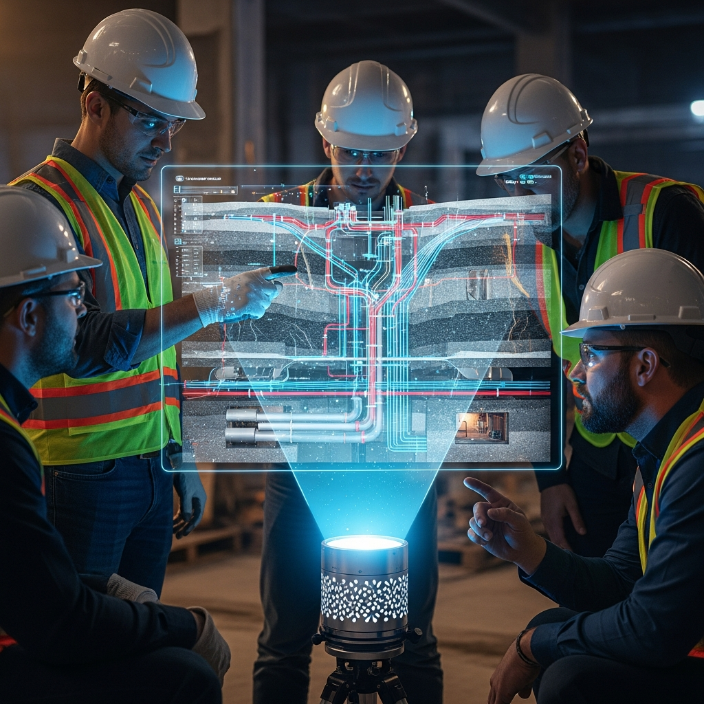
Beneath our feet lies a tangled, chaotic web of history and modern necessity: centuries-old sewers, high-voltage cables, fiber optic lines, and forgotten tunnels. For construction crews and civil engineers, this invisible layer is a constant hazard. A single misjudged excavation can sever critical infrastructure, leading to blackouts, flooding, or worse. While ground-penetrating radar (GPR) has long been the standard tool for mapping the subsurface, it has limitations, struggling with depth, soil composition, and resolution.
Enter the quantum gravity gradiometer. Once the domain of theoretical physics and laboratory experiments, these ultra-sensitive devices are moving into the field, promising to revolutionize how we see the world beneath us. By detecting minute variations in the Earth’s gravitational field, they offer a way to map underground voids and density changes with unprecedented precision, bypassing the limitations of electromagnetic sensing.
The Principle of Quantum Sensing
At the heart of this technology is the principle of atom interferometry. Traditional gravity meters (gravimeters) use springs or falling masses to measure gravitational acceleration, but they are prone to drift and environmental noise. Quantum sensors, however, exploit the wave-particle duality of atoms.
In a typical setup, a cloud of atoms—often rubidium—is cooled to near absolute zero using lasers, forming a Bose-Einstein Condensate. At these temperatures, the atoms behave less like billiard balls and more like waves. A series of laser pulses then acts as a beam splitter and mirror for these matter waves, separating the atomic wave function into two paths that travel at different heights. Because gravity varies slightly with height (the gradient), the two paths experience a different phase shift. When the paths are recombined, the interference pattern reveals the precise gravitational acceleration.
A gravity gradiometer takes this a step further by using two clouds of atoms separated by a vertical distance. By measuring the difference in gravity between the two clouds simultaneously, the device cancels out common-mode noise—like the vibrations from a passing truck or microseismic activity—leaving only the signal from the local mass distribution. This differential measurement is crucial for operating in noisy, real-world environments.
From Lab Bench to Construction Site
The transition from optical tables to portable devices has been the primary engineering challenge of the last decade. Early systems were room-sized behemoths requiring vacuum pumps and complex laser alignments. Recent advancements in micro-electro-mechanical systems (MEMS) and photonic integration have allowed for significant miniaturization.
Companies like Teledyne e2v and startups like Muquans (now part of iXblue) have demonstrated field-deployable units. In a landmark 2022 trial in Birmingham, UK, researchers successfully used a quantum gravity gradiometer to detect a hidden underground tunnel with a signal-to-noise ratio that far exceeded classical sensors. The device mapped the tunnel’s location and dimensions without any physical contact with the ground.
The implications for civil engineering are profound. Were moving from dig and hope to scan and plan,” says Dr. Elena Rostova, a geophysicist specializing in urban sensing. “With quantum gradiometry, we can detect density anomalies that GPR misses entirely, like plastic pipes in clay soil or voids that havent yet caused a surface collapse.
Mapping the Unmappable
One of the most immediate applications is in mapping unmappable utilities. Plastic and ceramic pipes, which do not reflect radar waves well, are invisible to GPR in many soil conditions. However, a pipe—whether full of water or air—creates a density contrast with the surrounding soil. A sufficiently sensitive gravity gradiometer can detect this mass deficit.
The sensitivity required is on the order of Eötvös units (1 E = 10^-9 s^-2). Current field-deployable quantum sensors are reaching sensitivities that can detect a 2-meter diameter tunnel at a depth of a few meters. As sensitivity improves, smaller features will become resolvable.
Beyond utilities, the technology has applications in archaeology (discovering buried structures without excavation), mining (locating ore bodies), and even groundwater monitoring (tracking aquifer depletion in real-time). The ability to see density directly provides a fundamental ground truth that other sensing modalities lack.
The Road Ahead: Cost and Complexity
Despite the promise, barriers to widespread adoption remain. The first is cost. These devices currently rely on expensive laser systems and vacuum components, pricing them out of routine surveys. However, as with all quantum technologies, costs are expected to drop as manufacturing scales and component technologies mature.
The second challenge is measurement speed. Atom interferometry is inherently a pulsed measurement, and building up a high-resolution map requires taking measurements at many grid points, each taking several seconds to minutes to average out noise. To be commercially viable for large-scale surveys, the data acquisition rate needs to increase, or the systems need to be mounted on moving platforms—a gravity scanner rather than a point-and-shoot device.
Researchers are tackling this by developing hybrid sensors that combine the long-term stability of quantum sensors with the high bandwidth of classical accelerometers. This fusion allows for continuous, high-speed measurements that are periodically corrected by the quantum reference, offering the best of both worlds.
As we continue to overcrowd our subsurface with infrastructure, the need for accurate 3D maps becomes critical. Quantum gravity gradiometers, once a scientific curiosity, are poised to become the eyes that guide our shovels, ensuring that the next time we dig, we know exactly what lies beneath.
Leave a Reply